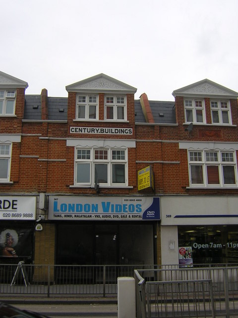
Century Buildings, London Road, Broad Green, Croydon
Introduction
The photograph on this page of Century Buildings, London Road, Broad Green, Croydon by Christopher Hilton as part of the Geograph project.
The Geograph project started in 2005 with the aim of publishing, organising and preserving representative images for every square kilometre of Great Britain, Ireland and the Isle of Man.
There are currently over 7.5m images from over 14,400 individuals and you can help contribute to the project by visiting https://www.geograph.org.uk

Image: © Christopher Hilton Taken: 2 Oct 2010
Broad Green is one of the more deprived bits of Croydon. When this building went up in 1901, large amounts of the map were coloured pink to show they belonged to the British Empire, but most people who saw it opened would doubtless have found it hard to imagine how the century to come would include natives of many corners of the former empire coming to live in Broad Green.

