36 Lime Street, Ouseburn, Newcastle Upon Tyne
Introduction
The photograph on this page of 36 Lime Street, Ouseburn, Newcastle Upon Tyne by Trevor Littlewood as part of the Geograph project.
The Geograph project started in 2005 with the aim of publishing, organising and preserving representative images for every square kilometre of Great Britain, Ireland and the Isle of Man.

There are currently over 7.5m images from over 14,400 individuals and you can help contribute to the project by visiting https://www.geograph.org.uk
36 Lime Street, Ouseburn, Newcastle Upon Tyne
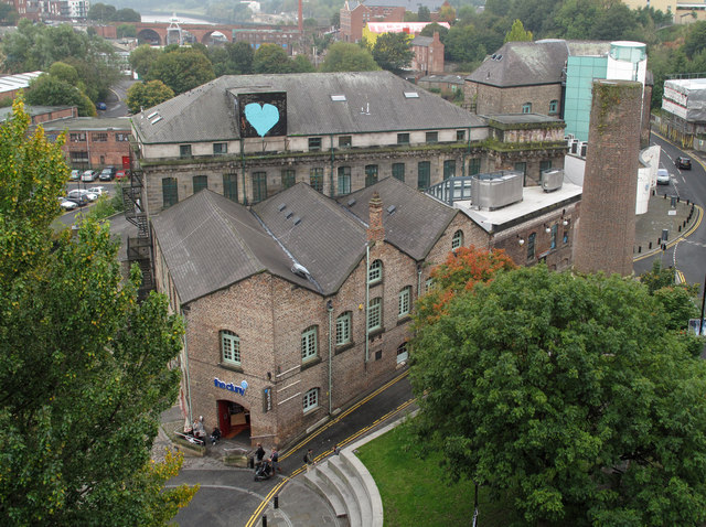
Image: © Trevor Littlewood Taken: 28 Sep 2010
36 Lime Street in the Ouseburn district of Newcastle has served many purposes since opening as a flax spinning mill in 1848. Its main present use is as 'The Cluny', a cafe-bar and a centre for live music.
Images are licensed for reuse under creativecommons.org/licenses/by-sa/2.0
Image Location
Latitude
54.974968
Longitude
-1.592065