Somersault signals, Carrickfergus station
Introduction
The photograph on this page of Somersault signals, Carrickfergus station by Albert Bridge as part of the Geograph project.
The Geograph project started in 2005 with the aim of publishing, organising and preserving representative images for every square kilometre of Great Britain, Ireland and the Isle of Man.

There are currently over 7.5m images from over 14,400 individuals and you can help contribute to the project by visiting https://www.geograph.org.uk
Somersault signals, Carrickfergus station
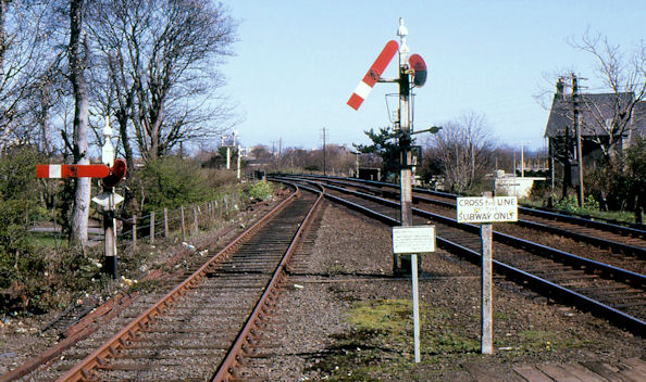
Image: © Albert Bridge Taken: 22 Apr 1984
Somersault signals were the standard form of signalling for the ex-Northern Counties Committee lines of NIR (except Belfast York Road – Greenisland and Bleach Green Jct – Monkstown Image which had colour lights dating from the 1930’s and Larne Harbour Image with upper-quadrant semaphores). This is Larne end of Carrickfergus station with the down starter on the right and the down starting signal from the loop on the left. See also Image
Images are licensed for reuse under creativecommons.org/licenses/by-sa/2.0
Image Location
Latitude
54.717732
Longitude
-5.808155