Old building on Coventry Road
Introduction
The photograph on this page of Old building on Coventry Road by E Gammie as part of the Geograph project.
The Geograph project started in 2005 with the aim of publishing, organising and preserving representative images for every square kilometre of Great Britain, Ireland and the Isle of Man.

There are currently over 7.5m images from over 14,400 individuals and you can help contribute to the project by visiting https://www.geograph.org.uk
Old building on Coventry Road
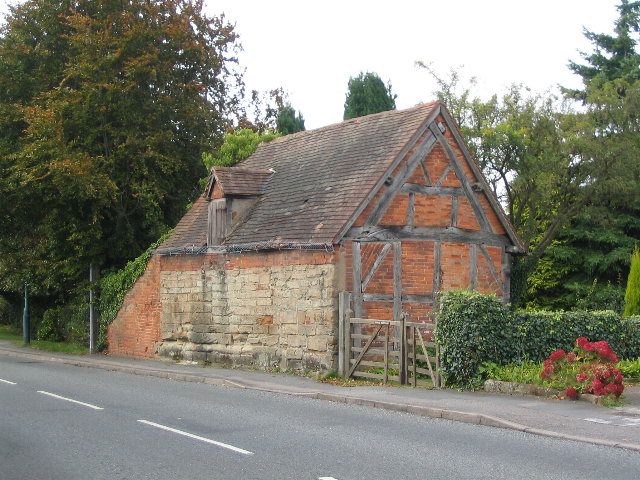
Image: © E Gammie Taken: 26 Sep 2010
At the top of Mill Hill. Sandstone and brick construction dating from ca. 17th century with timber frame and tile roof. A grade II listed building.
Images are licensed for reuse under creativecommons.org/licenses/by-sa/2.0
Image Location


Leaflet Map data © OpenStreetMap
Latitude
52.372778
Longitude
-1.497757