
East elevation, Lydiard House, Lydiard Park, Swindon
Introduction
The photograph on this page of East elevation, Lydiard House, Lydiard Park, Swindon by Brian Robert Marshall as part of the Geograph project.
The Geograph project started in 2005 with the aim of publishing, organising and preserving representative images for every square kilometre of Great Britain, Ireland and the Isle of Man.

There are currently over 7.5m images from over 14,400 individuals and you can help contribute to the project by visiting https://www.geograph.org.uk
East elevation, Lydiard House, Lydiard Park, Swindon
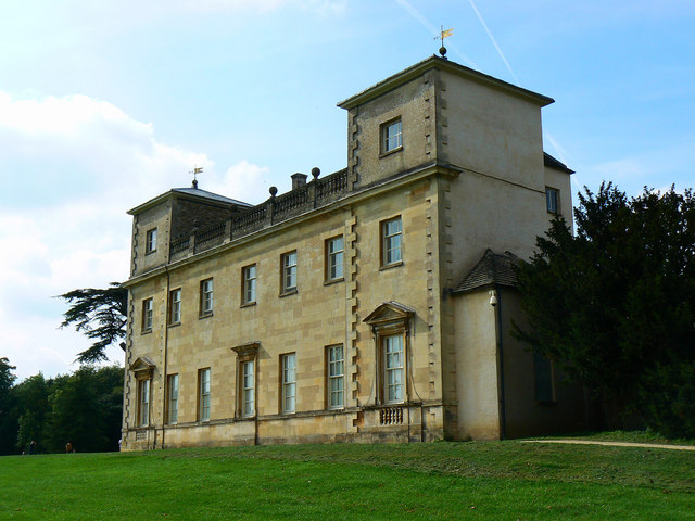
Image: © Brian Robert Marshall Taken: 22 Sep 2010
More about the Palladian mansion can be discovered in the description to this image Image The house was rescued from ruination when it was purchased for peanuts in 1943 by Swindon Corporation. I understand that by that time the family who had owned it for centuries were down to one member and no money. As the roof deteriorated the surviving aristocrat retreated from room to room in search of one where the rain hadn't yet penetrated. There weren't many of them left when the council stepped in.
Images are licensed for reuse under creativecommons.org/licenses/by-sa/2.0
Image Location

Latitude
51.561266
Longitude
-1.851369