
The Blackbird Inn, Ponteland
Introduction
The photograph on this page of The Blackbird Inn, Ponteland by Andrew Curtis as part of the Geograph project.
The Geograph project started in 2005 with the aim of publishing, organising and preserving representative images for every square kilometre of Great Britain, Ireland and the Isle of Man.

There are currently over 7.5m images from over 14,400 individuals and you can help contribute to the project by visiting https://www.geograph.org.uk
The Blackbird Inn, Ponteland
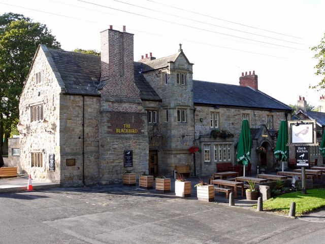
Image: © Andrew Curtis Taken: 24 Sep 2010
The left side incorporates the ruins of a medieval fortified tower. It was occupied by the Earls of Athol in C14th (their story is here http://en.wikipedia.org/wiki/David_II_Strathbogie,_Earl_of_Atholl ), was raided by the Scots in 1388, and rebuilt in the C17th. It fell into ruins and was roofless until 1935, when it was restored and built into the inn http://www.keystothepast.info/article/10339/Site-Details?PRN=N10991 Newcastle Libraries has a photo from c1910 here http://www.flickr.com/photos/newcastlelibraries/4075476849/in/set-72157622716905976/ There is said to be a hidden tunnel starting behind the fireplace, in the tunnel room of the Inn, to either St Mary's Church on the opposite side of North Street or to the Vicar's Pele. The place has a long history and there are undoubtedly a few skeletons in the cupboards. Before the castle, the site was a knoll in the marshes, thought to be the location of the signing of a peace treaty between Henry III of England and Alexander of Scotland in 1242. At the negotiations a marriage was planned between Alexander's eldest son and Henry's eldest daughter, although they were only aged 3 and 4 respectively at the time. http://www.northofthetyne.co.uk/Ponteland.html The Blackbird Inn is a Grade II* Listed Building (List Entry Number: 1042690): https://historicengland.org.uk/listing/the-list/list-entry/1042690 Ponteland Castle on Gatehouse: http://www.gatehouse-gazetteer.info/English%20sites/2770.html
Images are licensed for reuse under creativecommons.org/licenses/by-sa/2.0
Image Location

Latitude
55.051133
Longitude
-1.742805