Darras Hall Grassland
Introduction
The photograph on this page of Darras Hall Grassland by Andrew Curtis as part of the Geograph project.
The Geograph project started in 2005 with the aim of publishing, organising and preserving representative images for every square kilometre of Great Britain, Ireland and the Isle of Man.

There are currently over 7.5m images from over 14,400 individuals and you can help contribute to the project by visiting https://www.geograph.org.uk
Darras Hall Grassland
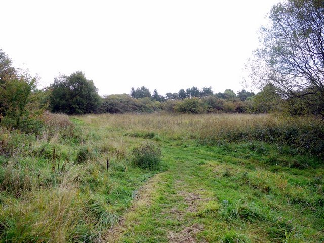
Image: © Andrew Curtis Taken: 24 Sep 2010
An area of grassland and scrub about 3 hectares in size, set aside as a recreation area when Darras Hall was developed as an upmarket housing development after 1907. The oval area is distinctly visible from the air, when taking off, or landing at Newcastle Airport. On the ground, it is well hidden by the surrounding houses on Middle Drive, Eastern Way and Woodlands, and known only to the local residents. It represents an unusual persistence of an old area of pasture, little managed apart from mowing and occasional control of hawthorn and gorse scrub. It is one of the few remaining areas of old lowland grassland in the county and contains some locally uncommon plant species. It was designated as an SSSI in 1984 http://www.english-nature.org.uk/citation/citation_photo/1000517.pdf
Images are licensed for reuse under creativecommons.org/licenses/by-sa/2.0
Image Location
Latitude
55.037589
Longitude
-1.754783