Cannon House, Hacket Lane, Thornbury: 2
Introduction
The photograph on this page of Cannon House, Hacket Lane, Thornbury: 2 by Robin Stott as part of the Geograph project.
The Geograph project started in 2005 with the aim of publishing, organising and preserving representative images for every square kilometre of Great Britain, Ireland and the Isle of Man.

There are currently over 7.5m images from over 14,400 individuals and you can help contribute to the project by visiting https://www.geograph.org.uk
Cannon House, Hacket Lane, Thornbury: 2
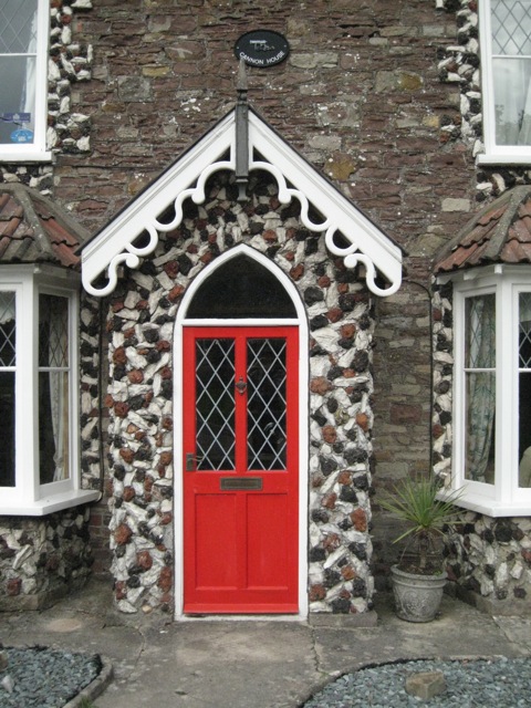
Image: © Robin Stott Taken: 18 Sep 2010
At the junction with Knapp Road. The eye-catching decoration on the quoins and around the windows and door is applied, perhaps to brickwork, and is formed of - hazarding a guess - red slag, black cinders, and a white material, perhaps broken limestone. The grey-purple undecorated masonry looks like Old Red Sandstone - and rather weathered at that.
Images are licensed for reuse under creativecommons.org/licenses/by-sa/2.0
Image Location
Latitude
51.610791
Longitude
-2.50785