The Red Burn flowing through a sea wall
Introduction
The photograph on this page of The Red Burn flowing through a sea wall by Lairich Rig as part of the Geograph project.
The Geograph project started in 2005 with the aim of publishing, organising and preserving representative images for every square kilometre of Great Britain, Ireland and the Isle of Man.

There are currently over 7.5m images from over 14,400 individuals and you can help contribute to the project by visiting https://www.geograph.org.uk
The Red Burn flowing through a sea wall
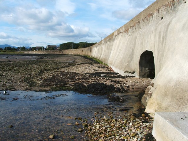
Image: © Lairich Rig Taken: 17 Sep 2010
The wall also serves to carry a railway line, and it was presumably the latter role that dictated its height, since the water level does not extend far up the wall, even at high tide; see Image However, there is another reason why the presence of the tunnel does not conflict with the function of the sea wall: on the far side of the wall, the burn is safely confined by embankments on either side. The photograph shows the Red Burn flowing out onto the beach, where it will empty into the Firth of Clyde. Compare Image, close to its source near Ben Bowie, and Image, which shows the surprisingly deep valley which it has carved out within a fairly short distance from its source.
Images are licensed for reuse under creativecommons.org/licenses/by-sa/2.0
Image Location
Latitude
55.992493
Longitude
-4.70146