Sea wall at Craigendoran
Introduction
The photograph on this page of Sea wall at Craigendoran by Lairich Rig as part of the Geograph project.
The Geograph project started in 2005 with the aim of publishing, organising and preserving representative images for every square kilometre of Great Britain, Ireland and the Isle of Man.

There are currently over 7.5m images from over 14,400 individuals and you can help contribute to the project by visiting https://www.geograph.org.uk
Sea wall at Craigendoran
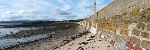
Image: © Lairich Rig Taken: 17 Sep 2010
While the incoming tide does reach the wall, the water level at high tide does not reach far above its base; presumably, the height of the wall is largely dictated by its other role, as an embankment for the railway line (compare Image). The photograph was taken from near the south-eastern end of the wall. The railway line closely follows the top of the wall until the latter comes to an end about 450 metres further ahead. Also located near that point is Craigendoran Junction, where the West Highland Railway begins, branching from the main Dumbarton-to-Helensburgh line (see the 1:25000 map).
Images are licensed for reuse under creativecommons.org/licenses/by-sa/2.0
Image Location
Latitude
55.992144
Longitude
-4.700955