Jordanstown station
Introduction
The photograph on this page of Jordanstown station by Albert Bridge as part of the Geograph project.
The Geograph project started in 2005 with the aim of publishing, organising and preserving representative images for every square kilometre of Great Britain, Ireland and the Isle of Man.

There are currently over 7.5m images from over 14,400 individuals and you can help contribute to the project by visiting https://www.geograph.org.uk
Jordanstown station
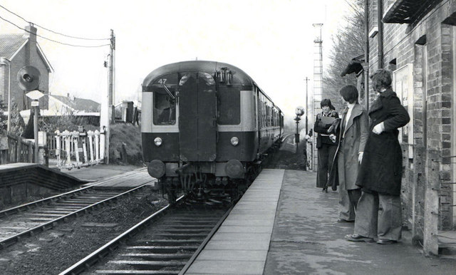
Image: © Albert Bridge Taken: 17 Mar 1976
A three-car MPD set calling at Jordanstown with the 17.05 Carrickfergus – Belfast York Road. The station building has been demolished. The level crossing is now automatic barriers. The track was bull-head rail on wooden sleepers and there was a searchlight signal (top left).
Images are licensed for reuse under creativecommons.org/licenses/by-sa/2.0
Image Location
Latitude
54.687372
Longitude
-5.894783