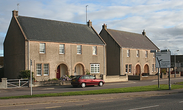
Harrison Terrace
Introduction
The photograph on this page of Harrison Terrace by Anne Burgess as part of the Geograph project.
The Geograph project started in 2005 with the aim of publishing, organising and preserving representative images for every square kilometre of Great Britain, Ireland and the Isle of Man.
There are currently over 7.5m images from over 14,400 individuals and you can help contribute to the project by visiting https://www.geograph.org.uk

Image: © Anne Burgess Taken: 20 Sep 2010
This row of houses is a Category B listed building. It was designed by John P M Wright in 1947, and building commenced in 1949. The arched doorways recall the arched 'piazzas' which formerly lined the High Street in Elgin, but have mostly been lost. The houses were built by Elgin Town Council, and demonstrate that it is possible to build attractive council housing in traditional style. The row is named after Provost Edward Harrison, who was keen to incorporate traditional vernacular elements. Sadly, some of the new owners have altered their windows, which has destroyed the unity and symmetry of the original design.

