Play and sports areas, John Perryn School
Introduction
The photograph on this page of Play and sports areas, John Perryn School by David Hawgood as part of the Geograph project.
The Geograph project started in 2005 with the aim of publishing, organising and preserving representative images for every square kilometre of Great Britain, Ireland and the Isle of Man.

There are currently over 7.5m images from over 14,400 individuals and you can help contribute to the project by visiting https://www.geograph.org.uk
Play and sports areas, John Perryn School
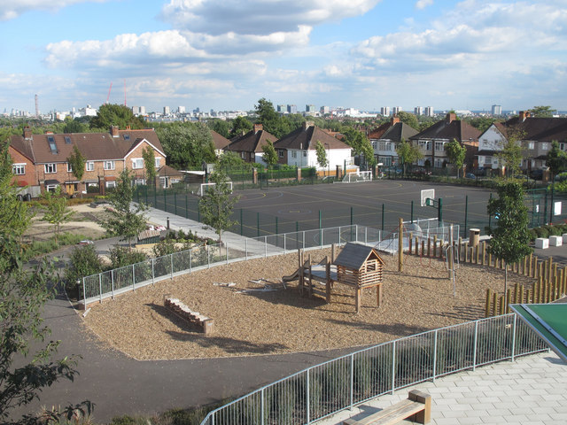
Image: © David Hawgood Taken: 18 Sep 2010
The school was rebuilt in 2009, see Image and Image The old school was on the area which is now a hard surfaced sports area. This wide view over London is from a first-floor classroom. The BT Tower is near the left of the photo, Earl's Court Exhibition is near the right.
Images are licensed for reuse under creativecommons.org/licenses/by-sa/2.0
Image Location
Latitude
51.519081
Longitude
-0.255586