The slopes of Mynydd Dinas, looking northwest
Introduction
The photograph on this page of The slopes of Mynydd Dinas, looking northwest by Natasha Ceridwen de Chroustchoff as part of the Geograph project.
The Geograph project started in 2005 with the aim of publishing, organising and preserving representative images for every square kilometre of Great Britain, Ireland and the Isle of Man.

There are currently over 7.5m images from over 14,400 individuals and you can help contribute to the project by visiting https://www.geograph.org.uk
The slopes of Mynydd Dinas, looking northwest
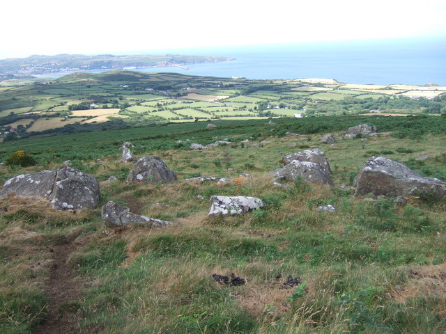
Image: © Natasha Ceridwen de Chroustchoff Taken: 23 Jul 2006
This view from near the top of the mountain towards Fishguard harbour and Pencaer in the distance, shows the gradation from rocky foreground to bracken-covered lower slopes and enclosed pasturelands beyond. The white shape of the Irish ferry can be just be made out as it prepares to leave the harbour.
Images are licensed for reuse under creativecommons.org/licenses/by-sa/2.0
Image Location
Latitude
52.000757
Longitude
-4.913526