Benchmark on L?n Priestley, Caernarfon
Introduction
The photograph on this page of Benchmark on L?n Priestley, Caernarfon by Meirion as part of the Geograph project.
The Geograph project started in 2005 with the aim of publishing, organising and preserving representative images for every square kilometre of Great Britain, Ireland and the Isle of Man.

There are currently over 7.5m images from over 14,400 individuals and you can help contribute to the project by visiting https://www.geograph.org.uk
Benchmark on L?n Priestley, Caernarfon
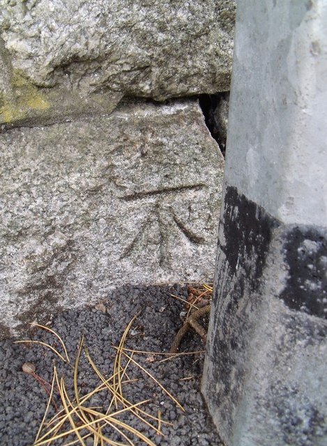
Image: © Meirion Taken: 15 Sep 2010
This benchmark is located on Lôn Priestley (Priestley Road) in Caernarfon. The mark is not shown in the current Ordnance Survey database but is shown on an 1888-1889 map of the area as being 162.8ft above the Liverpool datum.
Images are licensed for reuse under creativecommons.org/licenses/by-sa/2.0
Image Location
Latitude
53.145114
Longitude
-4.265225