
St Andrew's church in Blickling - memorial
Introduction
The photograph on this page of St Andrew's church in Blickling - memorial by Evelyn Simak as part of the Geograph project.
The Geograph project started in 2005 with the aim of publishing, organising and preserving representative images for every square kilometre of Great Britain, Ireland and the Isle of Man.

There are currently over 7.5m images from over 14,400 individuals and you can help contribute to the project by visiting https://www.geograph.org.uk
St Andrew's church in Blickling - memorial
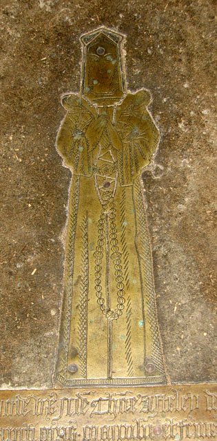
Image: © Evelyn Simak Taken: 17 Sep 2010
St Andrew's church > http://www.geograph.org.uk/photo/2070223 is situated on an elevation to the south-east of Blickling Hall, right beside Blickling Road and next-door to the entrance to the Hall. The church was almost completely rebuilt in the 19th century but has retained a number of figure brasses > http://www.geograph.org.uk/photo/2070258 - some commemorating members of the Boleyn family and Anne Boleyn who spent her childhood at Blickling Hall. The baptismal font > http://www.geograph.org.uk/photo/2070263 dates from the 15th century, the stained glass > http://www.geograph.org.uk/photo/2070234 is Victorian.
Images are licensed for reuse under creativecommons.org/licenses/by-sa/2.0
Image Location

Latitude
52.810097
Longitude
1.231202