Pendlestone Mills
Introduction
The photograph on this page of Pendlestone Mills by Chris Allen as part of the Geograph project.
The Geograph project started in 2005 with the aim of publishing, organising and preserving representative images for every square kilometre of Great Britain, Ireland and the Isle of Man.

There are currently over 7.5m images from over 14,400 individuals and you can help contribute to the project by visiting https://www.geograph.org.uk
Pendlestone Mills
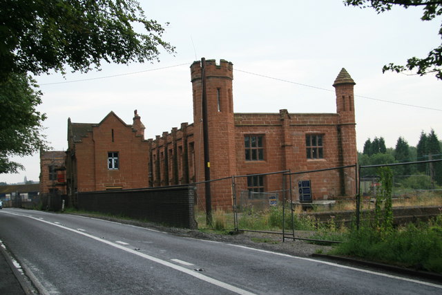
Image: © Chris Allen Taken: 22 Jul 2006
Also known as Fort Pendlestone. Originally there was a corn mill on the site but this is a more recent cotton mill. It was originally water powered but was later supplemented by a vertical steam engine of Yorkshire build. The late George Watkins photographed this in 1953 but it's long gone. The Mills are rather fine but squeezed in beside the road and currently fenced off. Need I say they are being adaptively reused, although it seems to have been ongoing for a couple of years.
Images are licensed for reuse under creativecommons.org/licenses/by-sa/2.0
Image Location
Latitude
52.545845
Longitude
-2.408425