Antony: Tregantle Fort
Introduction
The photograph on this page of Antony: Tregantle Fort by Martin Bodman as part of the Geograph project.
The Geograph project started in 2005 with the aim of publishing, organising and preserving representative images for every square kilometre of Great Britain, Ireland and the Isle of Man.

There are currently over 7.5m images from over 14,400 individuals and you can help contribute to the project by visiting https://www.geograph.org.uk
Antony: Tregantle Fort
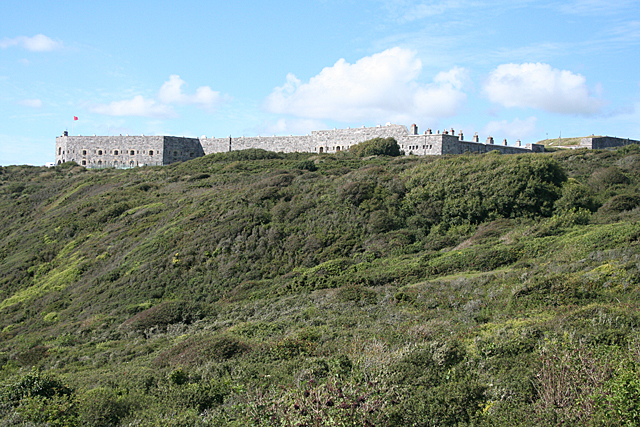
Image: © Martin Bodman Taken: 9 Sep 2010
One of Lord Palmerston's 'follies', built in 1865 and still forming part of the UK's Defence Estate. When constructed it accommodated 1000 men in barracks and housed a number of long-range guns. It was part of an extensive - and expensive - ring of forts designed to protect Devonport and Plymouth Sound from invasion by the French. The Franco-Prussian war of the 1870s rendered it somewhat irrelevant. Late in the 19th century it was supplied by a narrow-gauge railway from Wacker Quay on the Lynher estuary, running via an inclined plane below Scraesdon Fort. In Antony parish
Images are licensed for reuse under creativecommons.org/licenses/by-sa/2.0
Image Location


Leaflet Map data © OpenStreetMap
Latitude
50.356521
Longitude
-4.27058