Sneinton Hermitage: remains of railway bridge
Introduction
The photograph on this page of Sneinton Hermitage: remains of railway bridge by John Sutton as part of the Geograph project.
The Geograph project started in 2005 with the aim of publishing, organising and preserving representative images for every square kilometre of Great Britain, Ireland and the Isle of Man.

There are currently over 7.5m images from over 14,400 individuals and you can help contribute to the project by visiting https://www.geograph.org.uk
Sneinton Hermitage: remains of railway bridge
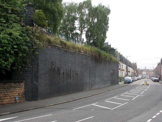
Image: © John Sutton Taken: 8 Sep 2010
The substantial blue-brick abutment on the left supported the four-track bridge which carried the London & North Western Railway goods branch from Trent Lane Junction to the Manvers Street goods yard, which was built into the side of the hill to the left. The LNWR gained access to Nottingham through the alliance with the Great Northern which led to the building of the GN&LNW Joint Line through the Vale of Belvoir to Melton Mowbray, Market Harborough and Northampton. The LNWR goods warehouse at Manvers Street was badly damaged by the Luftwaffe in Nottingham's biggest air raids in May 1941. The goods yard site is now occupied by houses of Newark Crescent and trees grow where wagons were shunted. Trams and later trolleybuses once ran along Sneinton Hermitage to the Colwick Road terminus.
Images are licensed for reuse under creativecommons.org/licenses/by-sa/2.0
Image Location
Latitude
52.948982
Longitude
-1.130791