The Mitchell Arms
Introduction
The photograph on this page of The Mitchell Arms by Gerald England as part of the Geograph project.
The Geograph project started in 2005 with the aim of publishing, organising and preserving representative images for every square kilometre of Great Britain, Ireland and the Isle of Man.

There are currently over 7.5m images from over 14,400 individuals and you can help contribute to the project by visiting https://www.geograph.org.uk
The Mitchell Arms
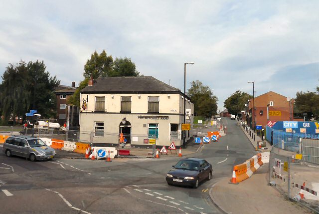
Image: © Gerald England Taken: 6 Sep 2010
The road on the right is Beswick Street. The roadworks are due to the construction of the Metrolink tramline to Droylsden and Ashton under Lyne. Merrill Street Image to the left is currently closed.
Images are licensed for reuse under creativecommons.org/licenses/by-sa/2.0
Image Location
Latitude
53.482668
Longitude
-2.21379