Starston Hollow Windpump
Introduction
The photograph on this page of Starston Hollow Windpump by Ashley Dace as part of the Geograph project.
The Geograph project started in 2005 with the aim of publishing, organising and preserving representative images for every square kilometre of Great Britain, Ireland and the Isle of Man.

There are currently over 7.5m images from over 14,400 individuals and you can help contribute to the project by visiting https://www.geograph.org.uk
Starston Hollow Windpump
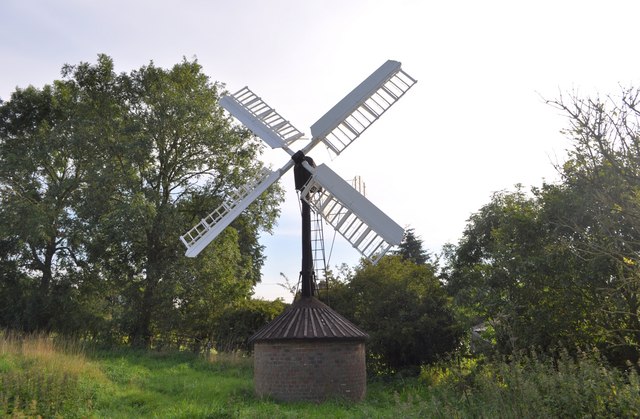
Image: © Ashley Dace Taken: 9 Sep 2010
This windpump, located in the corner of a field south of The Street, is a Grade 2 Scheduled Ancient Monument and believed to be the only one of its type left. It was erected in 1832 and has been restored with help from English Heritage and Norfolk County Council. It pumped water from the nearby beck to massive tanks at a nearby home and also a local farm.
Images are licensed for reuse under creativecommons.org/licenses/by-sa/2.0
Image Location
Latitude
52.411862
Longitude
1.280236