End of Lumb Lane
Introduction
The photograph on this page of End of Lumb Lane by Gerald England as part of the Geograph project.
The Geograph project started in 2005 with the aim of publishing, organising and preserving representative images for every square kilometre of Great Britain, Ireland and the Isle of Man.

There are currently over 7.5m images from over 14,400 individuals and you can help contribute to the project by visiting https://www.geograph.org.uk
End of Lumb Lane
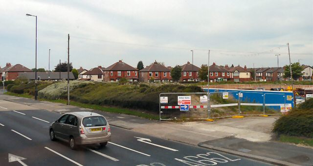
Image: © Gerald England Taken: 6 Sep 2010
The houses in the background are on Lumb Lane. The inside of the triangle formed by Lumb Lane, Manchester Road (the A635) and Droylsden Road (the A662) used to have nice semi-detached houses along Lumb Lane and Manchester Road, whilst there was filling station on Droylsden Road. The houses and filling station were demolished when the Metrolink extension to Ashton was first mooted. Later high hedges were planted around the site. Currently the area is being used as a storage and operational site for work on the Metrolink.
Images are licensed for reuse under creativecommons.org/licenses/by-sa/2.0
Image Location
Latitude
53.477753
Longitude
-2.13195