
Dudley Street in Wolverhampton
Introduction
The photograph on this page of Dudley Street in Wolverhampton by Roger D Kidd as part of the Geograph project.
The Geograph project started in 2005 with the aim of publishing, organising and preserving representative images for every square kilometre of Great Britain, Ireland and the Isle of Man.

There are currently over 7.5m images from over 14,400 individuals and you can help contribute to the project by visiting https://www.geograph.org.uk
Dudley Street in Wolverhampton
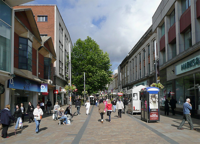
Image: © Roger D Kidd Taken: 7 Sep 2010
Pedestrianised since about 1974. The current paving was laid in about 2006. This image shows the street looking towards Queen Square. Marks and Spencer is on the right. Shops surrounding the Mander Centre are on the left. Update: It was been announced in June 2025 that Marks and Spener's will close after more tha 100 years in Wolverhampton. I have noticed during the several years of pedestrianisation that footfall in the city centre is very sparse much of the time, compared with when I first came here in 1975. I wonder sometimes how most businesses are still viable.
Images are licensed for reuse under creativecommons.org/licenses/by-sa/2.0
Image Location

Latitude
52.584869
Longitude
-2.126738