Maidenhead Bridge
Introduction
The photograph on this page of Maidenhead Bridge by Nigel Cox as part of the Geograph project.
The Geograph project started in 2005 with the aim of publishing, organising and preserving representative images for every square kilometre of Great Britain, Ireland and the Isle of Man.

There are currently over 7.5m images from over 14,400 individuals and you can help contribute to the project by visiting https://www.geograph.org.uk
Maidenhead Bridge
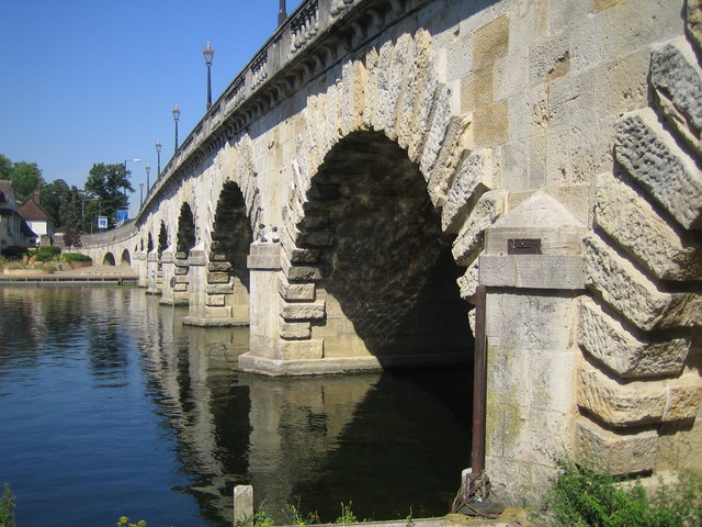
Image: © Nigel Cox Taken: 19 Jul 2006
The bridge carries the A4 Bath Road over the River Thames. It was designed by the architect Robert Taylor and built at a cost of £19,000 in 1777. It was a toll bridge until 1903, when motorists decided they were no longer prepared to pay and threw the gates into the river. The bridge has 12 arches of which the middle 6 are over the water, with the middle two navigable. The first bridge over the river here was built out of wood in 1280. The centre of the small metal plaque on the near abutment records the maximum water level reached during the November 1894 flood event.
Images are licensed for reuse under creativecommons.org/licenses/by-sa/2.0
Image Location
Latitude
51.523439
Longitude
-0.702707