Foxglove Meadows, Newport
Introduction
The photograph on this page of Foxglove Meadows, Newport by Jaggery as part of the Geograph project.
The Geograph project started in 2005 with the aim of publishing, organising and preserving representative images for every square kilometre of Great Britain, Ireland and the Isle of Man.

There are currently over 7.5m images from over 14,400 individuals and you can help contribute to the project by visiting https://www.geograph.org.uk
Foxglove Meadows, Newport
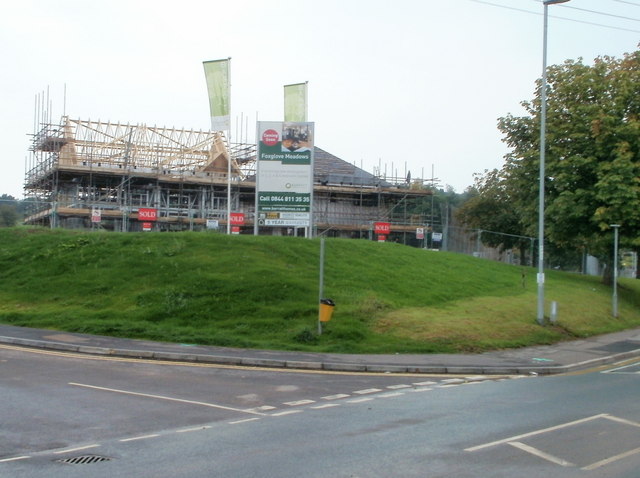
Image: © Jaggery Taken: 5 Sep 2010
Located on the south side of Bettws Lane, Foxglove Meadows is a Barratt Homes development of 2- 3- 4- and 5-bedroom houses, occupying the site of the former Bettws High School, which was replaced by Newport High School http://www.geograph.org.uk/photo/1610526 which opened nearby in autumn 2009. Seen here are two partly-built houses at the northern edge of the site.
Images are licensed for reuse under creativecommons.org/licenses/by-sa/2.0
Image Location
Latitude
51.608014
Longitude
-3.018006