Cowfold Village Hall
Introduction
The photograph on this page of Cowfold Village Hall by Simon Carey as part of the Geograph project.
The Geograph project started in 2005 with the aim of publishing, organising and preserving representative images for every square kilometre of Great Britain, Ireland and the Isle of Man.

There are currently over 7.5m images from over 14,400 individuals and you can help contribute to the project by visiting https://www.geograph.org.uk
Cowfold Village Hall
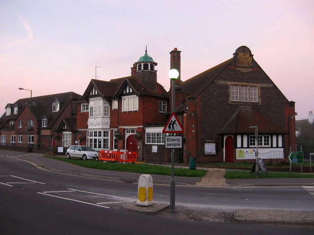
Image: © Simon Carey Taken: 4 Sep 2010
Located on the corner of Bolney Road, the A272, and Henfield Road, the A281. Built in 1896 the building originally included both a hall and a library. Taken a few minutes before sunrise.
Images are licensed for reuse under creativecommons.org/licenses/by-sa/2.0
Image Location
Latitude
50.989294
Longitude
-0.272102