Ashton Canal, Beswick
Introduction
The photograph on this page of Ashton Canal, Beswick by Stephen McKay as part of the Geograph project.
The Geograph project started in 2005 with the aim of publishing, organising and preserving representative images for every square kilometre of Great Britain, Ireland and the Isle of Man.

There are currently over 7.5m images from over 14,400 individuals and you can help contribute to the project by visiting https://www.geograph.org.uk
Ashton Canal, Beswick
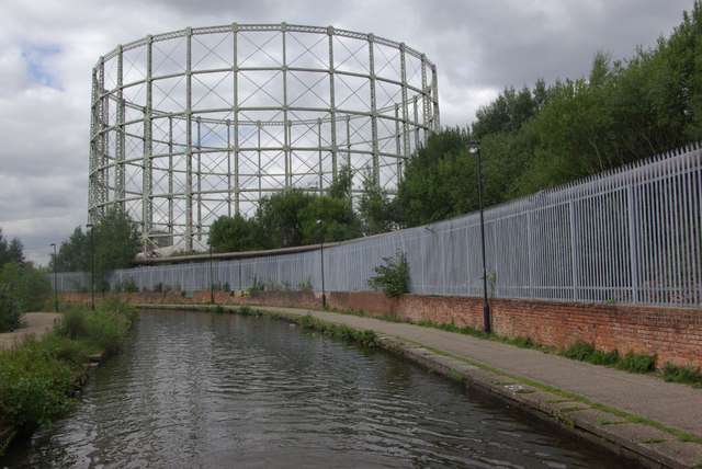
Image: © Stephen McKay Taken: 30 Aug 2010
Today, the Ashton Canal which runs east from Manchester city centre, through some of the city's grimmer districts, is considered an essential link in the northern canal network and it is a measure of how much attitudes have changed that in the 1960s there were plans to close and culvert it. For many years following its reprieve, the canal had a fearsome reputation for boaters, not only for the industrial surroundings and the number of locks, but also because it was prone to vandalism and other anti-social activity. Things seem to have improved in recent years as new developments such as the City of Manchester stadium have begun to change the character of the area. Nevertheless, there are industrial reminders everywhere including this gas holder seen from below bridge 7.
Images are licensed for reuse under creativecommons.org/licenses/by-sa/2.0
Image Location
Latitude
53.486094
Longitude
-2.20793