Telecommunications Flying Unit memorial
Introduction
The photograph on this page of Telecommunications Flying Unit memorial by Bob Embleton as part of the Geograph project.
The Geograph project started in 2005 with the aim of publishing, organising and preserving representative images for every square kilometre of Great Britain, Ireland and the Isle of Man.

There are currently over 7.5m images from over 14,400 individuals and you can help contribute to the project by visiting https://www.geograph.org.uk
Telecommunications Flying Unit memorial
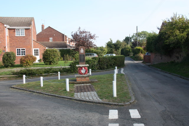
Image: © Bob Embleton Taken: 3 Sep 2010
In Church Lane, north of the churchyard. The Telecommunications Flying Unit (later called the Radar Research Flying Unit) flew from Defford Airfield from 1941 to 1957, for the Malvern radar scientists. Radar Research moved to the safe haven of Malvern in May 1942 and has evolved over the years into Qinetiq. This monument, unveiled by Sir Bernard Lovell on Tuesday 10th September 2002, is dedicated to the RAF and civilian personnel who lost their lives in the furtherance of radar research. In the 1950s the Defford Airfield was found to be too small for the V bombers so radar flight testing moved to Pershore Airfield. http://www.doramusic.com/defford.htm Image Image
Images are licensed for reuse under creativecommons.org/licenses/by-sa/2.0
Image Location
Latitude
52.087357
Longitude
-2.121965