Brockweir Quay
Introduction
The photograph on this page of Brockweir Quay by Roy Parkhouse as part of the Geograph project.
The Geograph project started in 2005 with the aim of publishing, organising and preserving representative images for every square kilometre of Great Britain, Ireland and the Isle of Man.

There are currently over 7.5m images from over 14,400 individuals and you can help contribute to the project by visiting https://www.geograph.org.uk
Brockweir Quay
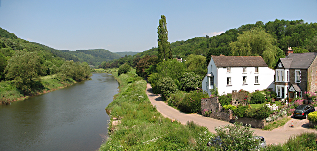
Image: © Roy Parkhouse Taken: 9 Jun 2006
All that is left of Brockweir Quay is in the centre foreground of this photograph. This is where the trows from Bristol would load/unload. Brockweir was once a busy port.
Images are licensed for reuse under creativecommons.org/licenses/by-sa/2.0
Image Location
Latitude
51.706724
Longitude
-2.669997