Viewland Road, Plumstead Common
Introduction
The photograph on this page of Viewland Road, Plumstead Common by Marathon as part of the Geograph project.
The Geograph project started in 2005 with the aim of publishing, organising and preserving representative images for every square kilometre of Great Britain, Ireland and the Isle of Man.

There are currently over 7.5m images from over 14,400 individuals and you can help contribute to the project by visiting https://www.geograph.org.uk
Viewland Road, Plumstead Common
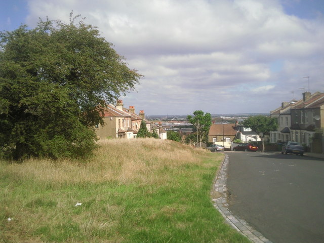
Image: © Marathon Taken: 30 Aug 2010
The ridge on which Plumstead Common lies provides fine views northwards across the Thames. This part of Plumstead Common is actually known as Winns Common and all the roads leading down from here to lower Plumstead are very steep. The road ahead is appropriately called Viewland Road and to the right is Heath Villas, giving another clue about the history of the Common.
Images are licensed for reuse under creativecommons.org/licenses/by-sa/2.0
Image Location
Latitude
51.483404
Longitude
0.094623