The recreation ground at Lauder
Introduction
The photograph on this page of The recreation ground at Lauder by Walter Baxter as part of the Geograph project.
The Geograph project started in 2005 with the aim of publishing, organising and preserving representative images for every square kilometre of Great Britain, Ireland and the Isle of Man.

There are currently over 7.5m images from over 14,400 individuals and you can help contribute to the project by visiting https://www.geograph.org.uk
The recreation ground at Lauder
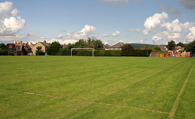
Image: © Walter Baxter Taken: 27 Aug 2010
This is a view of the northeast end of the football pitch at the only green public space in the town. A Scottish Borders Council and NHS Borders partnership project is planned for this area to provide a new community health centre, new sports changing facility and new children’s play park area. This planned development has still to be agreed however, as an action group called Protect Our Greenfield Site (POGS) have opposed the plans on the grounds that it will reduce the green space in the town. The existing play area on the right Image] is to be relocated with an adventure trail on the northwest side of the football pitch to make way for a new health centre with associated car parking. The L-shaped building would also occupy a part of the park behind the goalposts alongside a new sports changing building. The existing changing facility in a former house Image] on the far left will be demolished. The project will see the minor relocation of the main football pitch and the creation of a new pitch at the southwest end of the park.
Images are licensed for reuse under creativecommons.org/licenses/by-sa/2.0
Image Location
Latitude
55.718623
Longitude
-2.750992