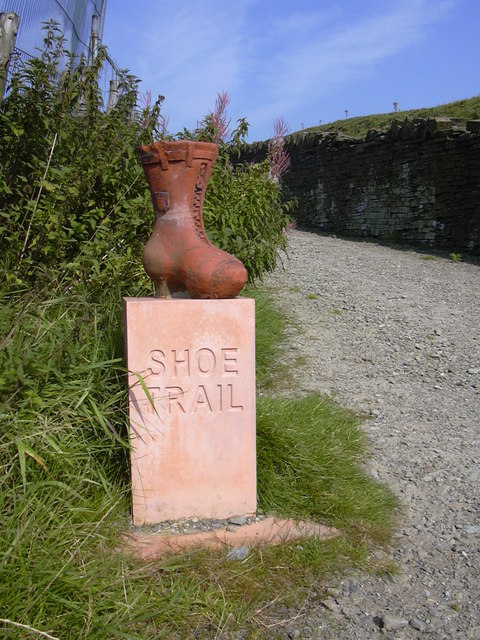
The Shoe Trail
Introduction
The photograph on this page of The Shoe Trail by Robert Wade as part of the Geograph project.
The Geograph project started in 2005 with the aim of publishing, organising and preserving representative images for every square kilometre of Great Britain, Ireland and the Isle of Man.
There are currently over 7.5m images from over 14,400 individuals and you can help contribute to the project by visiting https://www.geograph.org.uk

Image: © Robert Wade Taken: 2 Sep 2010
Twenty-eight giant clay shoes have been installed along a trail to show visitors the way between Rawtenstall train station and the Halo Panopticon in Haslingden. The Shoe Trail, installed by Groundwork Pennine Lancashire, aims to boost the number of people visiting the Halo. The shoes are positioned at regular intervals and key sites along the trail and have information plaques mounted on them highlighting things of interest. The shoes were designed by students from All Saints High School and Haslingden High School and have been hand carved by artist Julie Miles. The trail celebrates Rossendale’s famous shoe industry and clay has been used because the site of the Halo at Top o’ Slate was once a clay pit supplying many nearby brick factories. Special carved relief brick plaques at the start and end of the trail celebrate the areas industry and landscapes. Thanks to the LET

