Staffordshire and Worcestershire Canal at Fordhouses, Wolverhampton
Introduction
The photograph on this page of Staffordshire and Worcestershire Canal at Fordhouses, Wolverhampton by Roger D Kidd as part of the Geograph project.
The Geograph project started in 2005 with the aim of publishing, organising and preserving representative images for every square kilometre of Great Britain, Ireland and the Isle of Man.

There are currently over 7.5m images from over 14,400 individuals and you can help contribute to the project by visiting https://www.geograph.org.uk
Staffordshire and Worcestershire Canal at Fordhouses, Wolverhampton
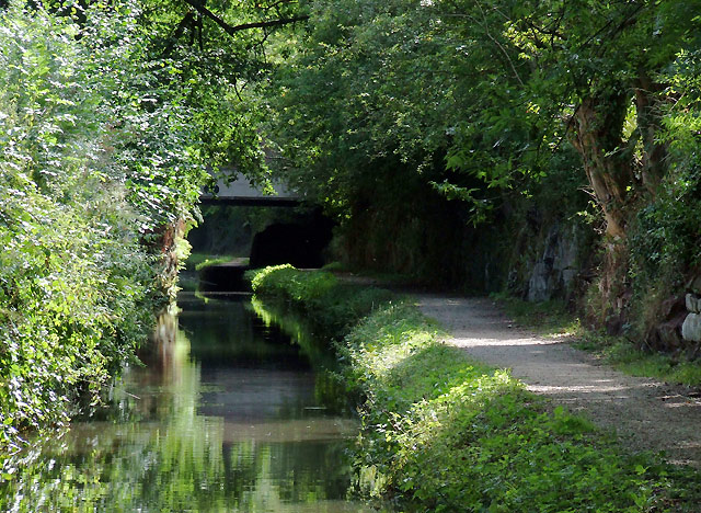
Image: © Roger D Kidd Taken: 17 Aug 2010
Here at Marsh Lane Narrows, the Staffordshire and Worcestershire Canal, carved as a cutting into the sandstone bedrock, is much less than the width of two boats. Overhanging trees contribute to making the route very shady and damp. Navigators cannot see whether a boat is approaching from the other direction, but there are two small passing places.
Images are licensed for reuse under creativecommons.org/licenses/by-sa/2.0
Image Location
Latitude
52.630616
Longitude
-2.136474