Start of footpath to Trago Mills
Introduction
The photograph on this page of Start of footpath to Trago Mills by Richard Dorrell as part of the Geograph project.
The Geograph project started in 2005 with the aim of publishing, organising and preserving representative images for every square kilometre of Great Britain, Ireland and the Isle of Man.

There are currently over 7.5m images from over 14,400 individuals and you can help contribute to the project by visiting https://www.geograph.org.uk
Start of footpath to Trago Mills
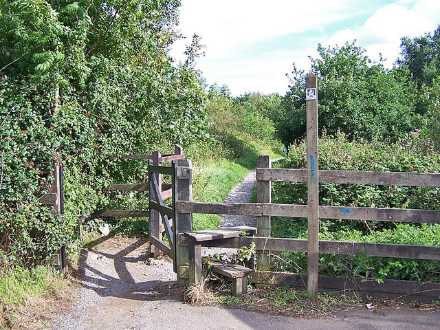
Image: © Richard Dorrell Taken: 28 Aug 2010
This entrance is from the old A38 close to Benedicts Bridge. The path follows the north bank of the Liverton Brook, and both path and brook go through a tunnel under the A38 dual carriageway (see Image] ). The path then gets rather lost in the Trago Mills car park complex.
Images are licensed for reuse under creativecommons.org/licenses/by-sa/2.0
Image Location
Latitude
50.559348
Longitude
-3.669948