Former Zoar Presbyterian Church, Maesycwmmer
Introduction
The photograph on this page of Former Zoar Presbyterian Church, Maesycwmmer by Jaggery as part of the Geograph project.
The Geograph project started in 2005 with the aim of publishing, organising and preserving representative images for every square kilometre of Great Britain, Ireland and the Isle of Man.

There are currently over 7.5m images from over 14,400 individuals and you can help contribute to the project by visiting https://www.geograph.org.uk
Former Zoar Presbyterian Church, Maesycwmmer
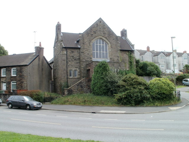
Image: © Jaggery Taken: 27 Aug 2010
Located on the corner of Main Road and Mount Pleasant. The final service here was in December 2008, 102 years after the church had opened for the first time. Formerly, the regular congregation was so large that many worshippers paid for a reserved seat. But in recent times, the congregation had dwindled to fewer than ten, making closure inevitable.
Images are licensed for reuse under creativecommons.org/licenses/by-sa/2.0
Image Location
Latitude
51.645639
Longitude
-3.22119