Trongate
Introduction
The photograph on this page of Trongate by David Dixon as part of the Geograph project.
The Geograph project started in 2005 with the aim of publishing, organising and preserving representative images for every square kilometre of Great Britain, Ireland and the Isle of Man.

There are currently over 7.5m images from over 14,400 individuals and you can help contribute to the project by visiting https://www.geograph.org.uk
Trongate
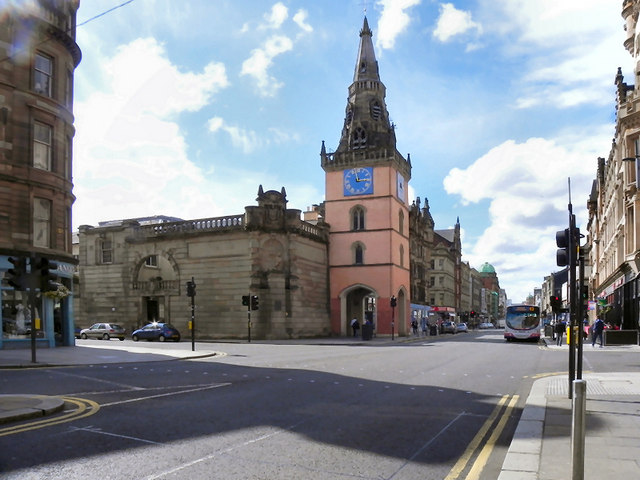
Image: © David Dixon Taken: 19 Aug 2010
The junction of Trongate and Chisholm Street. The pink tower is Image], a 17th Century addition to a much earlier church which was destroyed by fire in 1793. The elaborate sandstone wall to the east of the tower at the corner of Chisholm Street is actually just a screen for an airshaft ventilating the Central low-level rail line.
Images are licensed for reuse under creativecommons.org/licenses/by-sa/2.0
Image Location
Latitude
55.856939
Longitude
-4.245528