Edge Lane Bridge
Introduction
The photograph on this page of Edge Lane Bridge by Derek Harper as part of the Geograph project.
The Geograph project started in 2005 with the aim of publishing, organising and preserving representative images for every square kilometre of Great Britain, Ireland and the Isle of Man.

There are currently over 7.5m images from over 14,400 individuals and you can help contribute to the project by visiting https://www.geograph.org.uk
Edge Lane Bridge
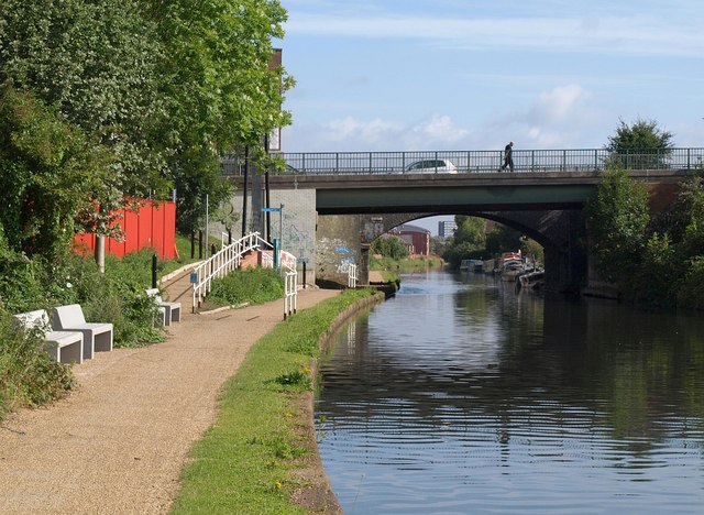
Image: © Derek Harper Taken: 19 Aug 2010
Or rather bridges; the newer, nearer span carries the westbound carriageways of Edge Lane (the A5145), while the further span carries the eastbound. See Image for another view of the red railings; that photo also demonstrates the way the towpath, its access and signage have been transformed in the intervening three years or so.
Images are licensed for reuse under creativecommons.org/licenses/by-sa/2.0
Image Location
Latitude
53.445526
Longitude
-2.305444