
Slieve Binnian, Mourne Mountains, Co Down
Introduction
The photograph on this page of Slieve Binnian, Mourne Mountains, Co Down by Geoff Flannagan as part of the Geograph project.
The Geograph project started in 2005 with the aim of publishing, organising and preserving representative images for every square kilometre of Great Britain, Ireland and the Isle of Man.

There are currently over 7.5m images from over 14,400 individuals and you can help contribute to the project by visiting https://www.geograph.org.uk
Slieve Binnian, Mourne Mountains, Co Down
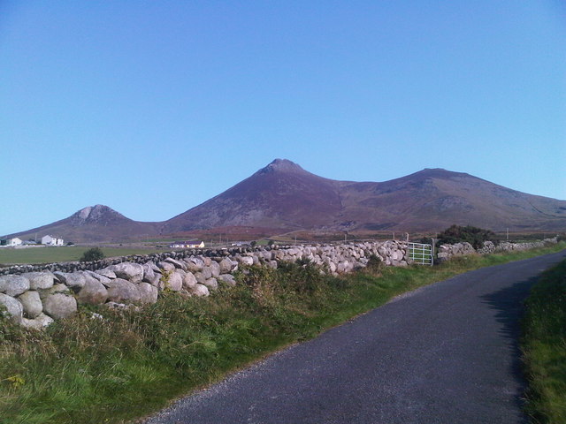
Image: © Geoff Flannagan Taken: 26 Aug 2010
This photo was taken from the Ballyveaghmore Road near the Head road. There are 12 peaks over 2000 feet high in the Mourne Mountains and are unusual in that their summits are grouped together in a compact area only 7 miles in breadth. The highest peak in the range is Slieve Donard rising to a height of 2,796 feet Nearly all the names for Mourne summits are derived from Irish. Slieve means mountain. Here are some mountain names explained. Slieve Donard (850m) Named after Domangard, a holy man who built a prayer cell on the mountain's summit. Slieve Commedagh (767m) Mountain of watching...lookout mountain. Slieve Binnian (747m) Mountain of the little horns. Binnian has a long summit ridge with rocky outcrops that look like horns. Slieve Bernagh (739m) Gapped or broken mountain, probably referring to the gap between Bernagh's twin summits. Slievelamagan (704m) A mountain crawled up using hands and feet.The mountain has a long steep ascent. Slieve Meelbeg (704m) and Slieve Meelmore (681m) Mountains of the small (beg) and large (more) animals. Ben Crom (524m) The stooped peak. Ben Crom's summit has a stooped profile from some angles. Slievenaglogh Two mountains have this name, (445m) at the Silent valley and (586m) east of Hare's Gap.
Images are licensed for reuse under creativecommons.org/licenses/by-sa/2.0
Image Location

Latitude
54.126313
Longitude
-5.95654