Surveying the water tower
Introduction
The photograph on this page of Surveying the water tower by Stephen Craven as part of the Geograph project.
The Geograph project started in 2005 with the aim of publishing, organising and preserving representative images for every square kilometre of Great Britain, Ireland and the Isle of Man.

There are currently over 7.5m images from over 14,400 individuals and you can help contribute to the project by visiting https://www.geograph.org.uk
Surveying the water tower
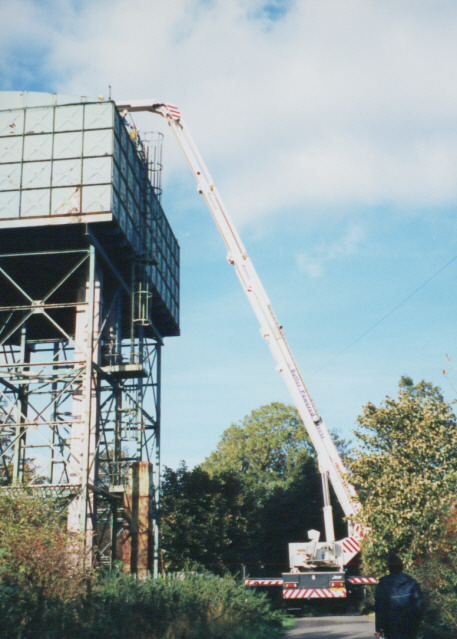
Image: © Stephen Craven Taken: 18 Oct 1995
A 'Bronto skylift' (allegedly the biggest hydraulic platform in the UK) being used to survey the water tower in Lilley Hall Lane. The tower was leaning dangerously due to mining subsidence and was subsequently demolished.
Images are licensed for reuse under creativecommons.org/licenses/by-sa/2.0
Image Location
Latitude
53.427664
Longitude
-1.223399