Dunham School Bridge
Introduction
The photograph on this page of Dunham School Bridge by Derek Harper as part of the Geograph project.
The Geograph project started in 2005 with the aim of publishing, organising and preserving representative images for every square kilometre of Great Britain, Ireland and the Isle of Man.

There are currently over 7.5m images from over 14,400 individuals and you can help contribute to the project by visiting https://www.geograph.org.uk
Dunham School Bridge
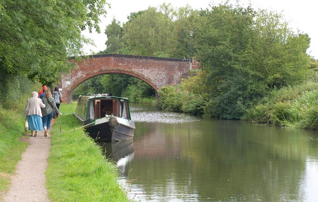
Image: © Derek Harper Taken: 18 Aug 2010
The bridge was engineered by John Gilbert http://www.britishlistedbuildings.co.uk/en-212878-dunham-school-bridge-dunham-massey . It carries School Lane over the Bridgewater Canal. The towpath here forms part of a good walk based around the nearby National Trust property of Dunham Massey.
Images are licensed for reuse under creativecommons.org/licenses/by-sa/2.0
Image Location
Latitude
53.389811
Longitude
-2.392857