Site of Carn Brea Station
Introduction
The photograph on this page of Site of Carn Brea Station by Ben Brooksbank as part of the Geograph project.
The Geograph project started in 2005 with the aim of publishing, organising and preserving representative images for every square kilometre of Great Britain, Ireland and the Isle of Man.

There are currently over 7.5m images from over 14,400 individuals and you can help contribute to the project by visiting https://www.geograph.org.uk
Site of Carn Brea Station
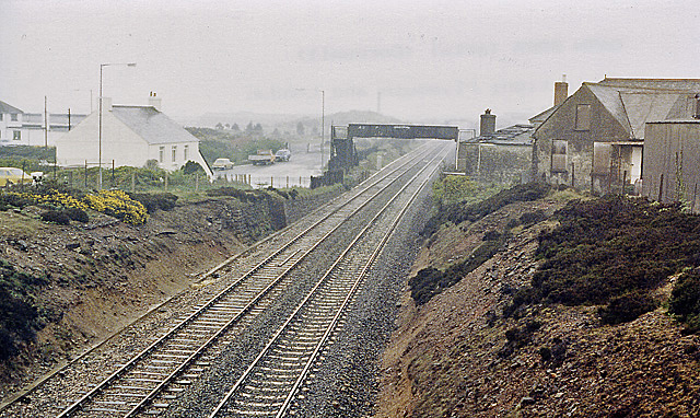
Image: © Ben Brooksbank Taken: 1 May 1987
View eastwards, towards Truro and Plymouth; Great Western Plymouth - Penzance main line. The station closed to passengers on 2/1/61, but remained for goods until 1/5/67. (There was little to show on a wet day 20 years later).
Images are licensed for reuse under creativecommons.org/licenses/by-sa/2.0
Image Location
Latitude
50.221409
Longitude
-5.2669