South Zeal Village
Introduction
The photograph on this page of South Zeal Village by pete kilgannon as part of the Geograph project.
The Geograph project started in 2005 with the aim of publishing, organising and preserving representative images for every square kilometre of Great Britain, Ireland and the Isle of Man.

There are currently over 7.5m images from over 14,400 individuals and you can help contribute to the project by visiting https://www.geograph.org.uk
South Zeal Village
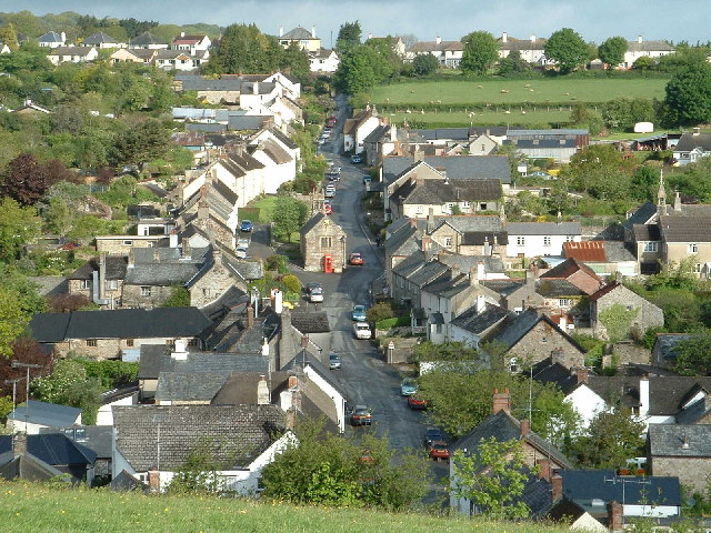
Image: © pete kilgannon Taken: 19 May 2003
With St. Mary's chapel in the centre and the South Tawton Primary School at 3 o/clock taken 19th May 2003
Images are licensed for reuse under creativecommons.org/licenses/by-sa/2.0
Image Location
Latitude
50.726292
Longitude
-3.914058