Old signpost near Llangrannog
Introduction
The photograph on this page of Old signpost near Llangrannog by Rudi Winter as part of the Geograph project.
The Geograph project started in 2005 with the aim of publishing, organising and preserving representative images for every square kilometre of Great Britain, Ireland and the Isle of Man.

There are currently over 7.5m images from over 14,400 individuals and you can help contribute to the project by visiting https://www.geograph.org.uk
Old signpost near Llangrannog
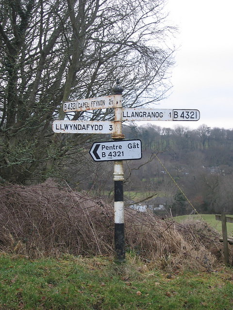
Image: © Rudi Winter Taken: 7 Feb 2010
Llangran(n)og has sprouted an extra 'n' since this signpost was installed. The modern addition pointing towards Pentre Gât is necessary because Capel Ffynnon, once a Methodist chapel on the main road (A487), has been converted into a dwelling, and the houses that have been built around it are now known as Pentre Gât or Pentregât.
Images are licensed for reuse under creativecommons.org/licenses/by-sa/2.0
Image Location
Latitude
52.162053
Longitude
-4.444718