Pentwynmawr Presbyterian Church
Introduction
The photograph on this page of Pentwynmawr Presbyterian Church by Jaggery as part of the Geograph project.
The Geograph project started in 2005 with the aim of publishing, organising and preserving representative images for every square kilometre of Great Britain, Ireland and the Isle of Man.

There are currently over 7.5m images from over 14,400 individuals and you can help contribute to the project by visiting https://www.geograph.org.uk
Pentwynmawr Presbyterian Church
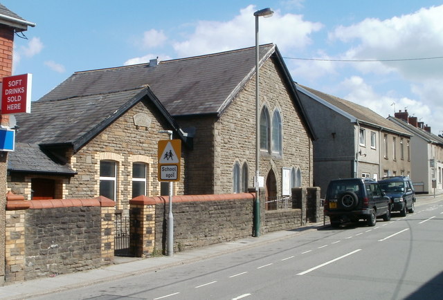
Image: © Jaggery Taken: 16 Aug 2010
Located on High Street. The smaller building (probably the church hall) has Davies's Memorial 1900 Chapel inscribed in stone above the windows. The school road sign is for Pentwynmawr Primary School, about 150 metres distant.
Images are licensed for reuse under creativecommons.org/licenses/by-sa/2.0
Image Location
Latitude
51.657884
Longitude
-3.166583