Cockburnspath, Berwickshire : All You Ever Wanted To Know About The Southern Upland Way
Introduction
The photograph on this page of Cockburnspath, Berwickshire : All You Ever Wanted To Know About The Southern Upland Way by Richard West as part of the Geograph project.
The Geograph project started in 2005 with the aim of publishing, organising and preserving representative images for every square kilometre of Great Britain, Ireland and the Isle of Man.

There are currently over 7.5m images from over 14,400 individuals and you can help contribute to the project by visiting https://www.geograph.org.uk
Cockburnspath, Berwickshire : All You Ever Wanted To Know About The Southern Upland Way
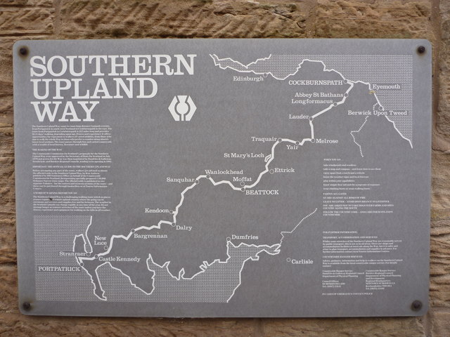
Image: © Richard West Taken: 16 Aug 2010
Co'path is at the eastern end of the Southern Upland Way, a 212 mile long footpath across southern Scotland. This information board is fixed to the wall in a narrow alleyway off the main street (near the village's only shop). Weary walkers hoping to refuel on tea and buns or celebrate their achievement with a pint will be sorely disappointed - there's nothing here but that one shop.
Images are licensed for reuse under creativecommons.org/licenses/by-sa/2.0
Image Location
Latitude
55.932165
Longitude
-2.361058