Ceredigion coastline north of Llangrannog
Introduction
The photograph on this page of Ceredigion coastline north of Llangrannog by Rudi Winter as part of the Geograph project.
The Geograph project started in 2005 with the aim of publishing, organising and preserving representative images for every square kilometre of Great Britain, Ireland and the Isle of Man.

There are currently over 7.5m images from over 14,400 individuals and you can help contribute to the project by visiting https://www.geograph.org.uk
Ceredigion coastline north of Llangrannog
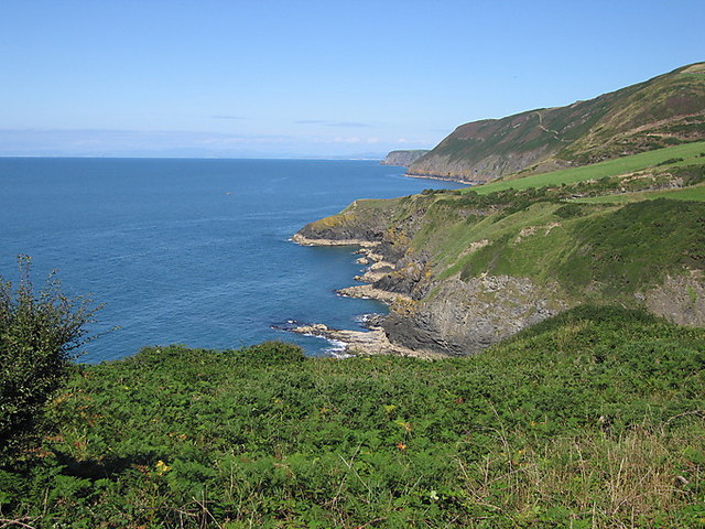
Image: © Rudi Winter Taken: 10 Aug 2010
The pointy headland in the middle distance is Trwyn Crou. In the far distance, Aberdyfi in SN6196 can be seen on the right, and Snowdon in SH6054 can be guessed just left of centre, some 103km away.
Images are licensed for reuse under creativecommons.org/licenses/by-sa/2.0
Image Location


Leaflet Map data © OpenStreetMap
Latitude
52.170592
Longitude
-4.444893