Bishops Lydeard Watermill
Introduction
The photograph on this page of Bishops Lydeard Watermill by Chris Allen as part of the Geograph project.
The Geograph project started in 2005 with the aim of publishing, organising and preserving representative images for every square kilometre of Great Britain, Ireland and the Isle of Man.

There are currently over 7.5m images from over 14,400 individuals and you can help contribute to the project by visiting https://www.geograph.org.uk
Bishops Lydeard Watermill
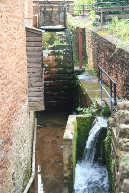
Image: © Chris Allen Taken: 15 Aug 2010
This shows the overshot waterwheel and the bypass arrangement. The wooden structure is the miller's privy with discharge straight into the tail race.
Images are licensed for reuse under creativecommons.org/licenses/by-sa/2.0
Image Location
Latitude
51.055576
Longitude
-3.186194