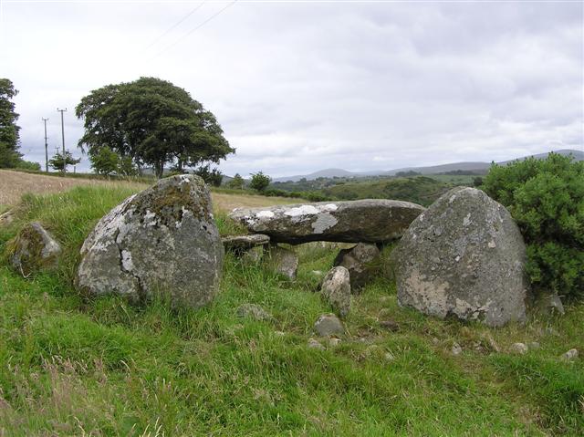
Loughash Tomb
Introduction
The photograph on this page of Loughash Tomb by Kenneth Allen as part of the Geograph project.
The Geograph project started in 2005 with the aim of publishing, organising and preserving representative images for every square kilometre of Great Britain, Ireland and the Isle of Man.
There are currently over 7.5m images from over 14,400 individuals and you can help contribute to the project by visiting https://www.geograph.org.uk

Image: © Kenneth Allen Taken: 11 Jul 2006
Known on the OS maps as 'Giants Grave', this burial tomb dates from around 4500 years ago. It is called a wedge tomb because it narrows in size from front to back and also decreases in height. There are twenty-two wedge tombs in Co Tyrone and over 500 in Ireland as a whole. This site is built on a terrace on a hillside sloping down from the north with Lough Ash as backdrop to the south. The entrance facing west has a double portal arrangement leading to the burial chamber. Originally the whole gallery would have been roofed with capstones, but only one now remains. It is enclosed by a wedge-shaped cairn. Oliver Davies excavated here in 1938 and several artefacts were uncovered in the gallery including a mould for a palstave (a type of axe), a bronze blade and a small copper ring. Fragments from four Beaker pots and about five other vessels were found along with various flint flakes. There was some charcoal and cremated bone, the remains of perhaps three individuals, the main burial being in a pit towards the back of the burial gallery. Other sites I have pictured are here http://sites.google.com/site/kennyallenswebsite/home/ancient-burial-sites

