Ravenhead Windmill
Introduction
The photograph on this page of Ravenhead Windmill by Raymond Knapman as part of the Geograph project.
The Geograph project started in 2005 with the aim of publishing, organising and preserving representative images for every square kilometre of Great Britain, Ireland and the Isle of Man.

There are currently over 7.5m images from over 14,400 individuals and you can help contribute to the project by visiting https://www.geograph.org.uk
Ravenhead Windmill
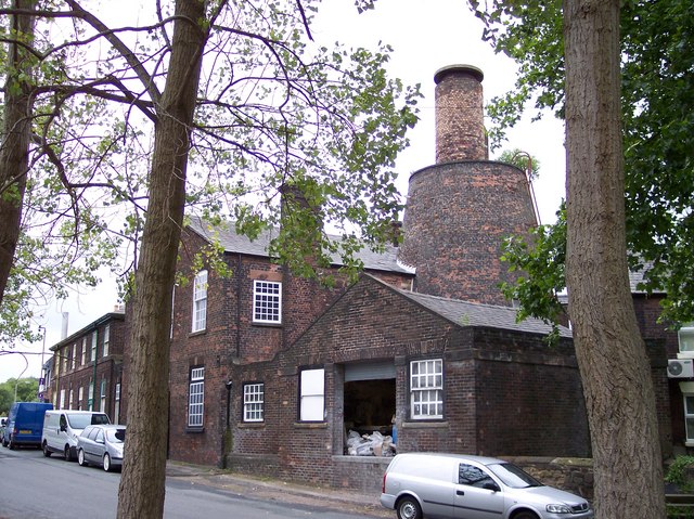
Image: © Raymond Knapman Taken: 11 Aug 2010
This windmill was originally used to drive machinery at British Cast Plate Manufactury.The turret on top was used as WW2 lookout
Images are licensed for reuse under creativecommons.org/licenses/by-sa/2.0
Image Location
Latitude
53.44265
Longitude
-2.751955