Musley School
Introduction
The photograph on this page of Musley School by Rob Candlish as part of the Geograph project.
The Geograph project started in 2005 with the aim of publishing, organising and preserving representative images for every square kilometre of Great Britain, Ireland and the Isle of Man.

There are currently over 7.5m images from over 14,400 individuals and you can help contribute to the project by visiting https://www.geograph.org.uk
Musley School
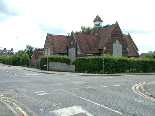
Image: © Rob Candlish Taken: 11 Aug 2010
The former Musley School seen from the junction of Homefield Road and Musley Hill. Hertfordshire County Council still own the building but seem undecided about what to do with it. Consequently it continues to deteriorate despite its Grade II listed status.
Images are licensed for reuse under creativecommons.org/licenses/by-sa/2.0
Image Location
Latitude
51.814283
Longitude
-0.027316